Summer Holidays in the Dolomites at Braies / Prags

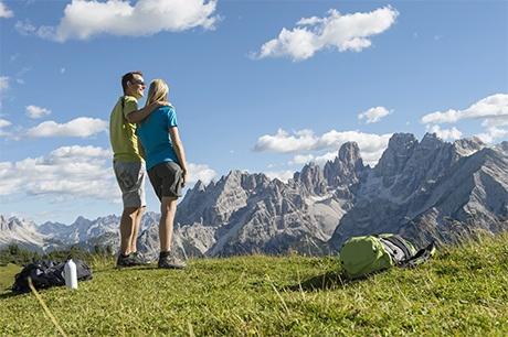
Hiking in Val Pusteria / Pustertal– a unique way to experience the Dolomites

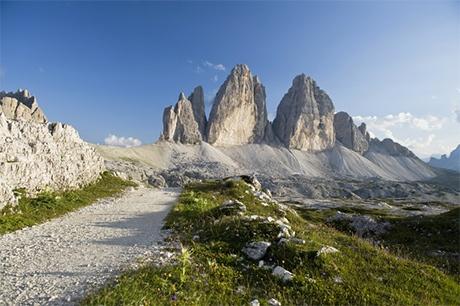
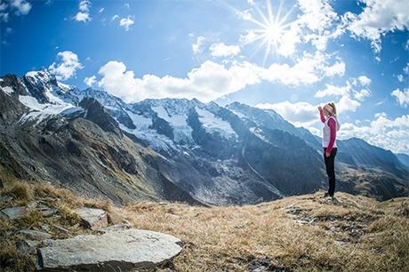
Hiking, Mountaineering & Climbing. Climb right up to the top to behold the world below.

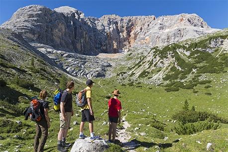
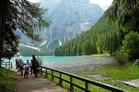
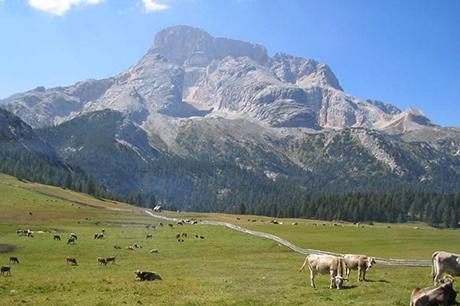
Braies / Prags (South Tyrol) is situated in the Fanes-Sennes-Prags Nature Reserve with its green meadows, rugged Dolomite mountain peaks, mountain lakes and countless footpaths. Across the whole Val Pusteria / Pustertal (Three Peaks holiday region) there is a network of footpaths, all well-marked and easily accessible even with a pushchair.

The forest air and blossoming mountain meadows will make your hike a really unique experience! For the more adventurous walkers there are also challenging hikes in the upper slopes and mountain climbs in store. Come and feel the Dolomites during your walking holidays.

 
South Tyrol Map powered by sentres - Outdoorportal and App for South Tyrol

Hiking Tours:

Easy
Hike around the Three Peaks
  • 9,6 km
Hike around the Three Peaks
  • 9,6 km
  • Mit dem Pkw oder Bus bis zur Auronzohütte.
  • 439 m
  • 439 m
From the Auronzo hut, start along the south side of the Three Peaks on path no. 101, past the Lavaredo hut (2,344m) on a slight incline to the Forcella Lavaredo (2,454m). Here, you’ll have your first wonderful view of the 500m-high north face of the Three Peaks (takes about an hour, also highly recommended for inexperienced hikers). On a light, downwards slope, cross under Monte Paterno until the fork in the road. Either take a) an easy ascent to the Tre Cime hut (2,405m), or b) a left, descending further down path no. 105. You’ll soon reach path no. 102, which leads up from Val Rienza. Ascending over path no. 105 (left), we arrive at the “Lange Alpe” mountain hut. Then, we hike past the Lange Alpe lake around the west side of the Three Peaks to the Auronzo hut.
Easy
Monte Piana Open-Air Museum
The peak of Monte Piana is reached over a traffic-free municipal road and runs from Lago di Misurina along the bendy and impressive First World War military road. Due to its 6km length and the 565m of difference in height, a shuttle-Jeep is available to you. This cuts your journey to the Bosi hut, some 5km away, to about 12 minutes. At the Bosi hut, 2,205m above sea level, you will find the Heldenkapelle, a chapel dedicated to those who fell in this mountain range in the two world wars. The footpath which leads on from here, takes you over the trenches and other features of the First World War open-air museum. By embarking on an approx. 1km track with a difference in altitude of about 120m, you can get to the southern peak, and the nearby Capanna Carducci, in about 20 minutes from the Bosi hut. The entire journey on the high plateau takes between 2½ and 4 hours. During this beautiful, relatively easy walk at an almost constant altitude, the views of the surrounding Dolomite mountains are truly unforgettable. The climb to the open-air museum is exposed and partly secured with ropes. Only for experienced hikers.
Normal
Valle di Casies Nature Trail Almweg 2000
  • Gsies - Valle di Casies
  • 4h 50min 15,1 km
Valle di Casies Nature Trail Almweg 2000
  • Gsies - Valle di Casies
  • 4h 50min 15,1 km
  • St. Magdalena Talschlusshütte
  • 896 m
  • 896 m

Take the road from Santa Maddalena briefly into the valley, then take a right over the stream and, following path 48 through the Köfler valley, continue southeast. When the path splits, take the right fork and follow the 48 (also a forest path) through the woods to the Tscharnietalm (1976m). From there, follow the path marked with red dots in a moderately steep, north westerly incline to a narrow ridge. On the other side, an equally light descent and crossing the slopes takes you north to the Kasermähder Hut (2048m), then further through the hillside – partly at the edge of the forest, partly above them to the Gipfelalm hut (2104m). Subsequently, you can either stick to the footpath for a bit longer and walk to the Kaser hut or head down a slight decline to the Stumpf hut (2003m, bar). On a wide access road, a comfortable walk brings you to the Kaser hut (2076m, food and drink available). From here, descend on the marked path into the wonderful Pfoital valley, briefly upwards to a bridge over a stream and then on the western slope marked path up to the Uwald hut (2042m, food and drink available). - Descent: From the Uwald Hut, take either the wide and comfortable, yet longer, forest path or the shorter, but quite steep, old footpath (12B), the lower part of which is identical to the ascent path.

Tips and special advice: The Valle di Casies has many beautiful mountain pastures, which feature a great deal of cosy inns where you can stop for a bite or some refreshment. This route leads you from hut to hut at an average altitude of about 2000 metres, hence the name ‘Almweg 2000’. There are various ways to access it, yet we recommend the altitude hike, well worth it when the flowers are in bloom, from the Tscharnietalm hut in the south to the Uwald hut in the north. This forms an enclosed circular hike when combined with the climbs and descents, and can also be attempted from the other direction. The tour is easy and very rewarding for experienced hikers.

Easy
Hiking Trail: Lake Braies – Grünwald pasture
  • Prags - Braies
  • 40min 2,2 km
Hiking Trail: Lake Braies – Grünwald pasture
  • Prags - Braies
  • 40min 2,2 km
  • Parkplatz Pragser Wildsee - Parcheggio Lago di Braies
  • 115 m
  • 27 m
At the southeast end of the lake, bear to the right and walk over the pine forests to the Grünwald hut.
Normal
Monte Specie
Monte Specie
  • 5,8 km
Monte Specie
Monte Specie
  • 5,8 km
  • Mit dem Pkw oder dem Linienbus bis nach Landro zum Hotel Drei Zinnen.
  • 942 m
  • 41 m
Starting point: Landro/Drei Zinnen Hotel in Val di Landro. From the Three Peaks View in Dobbiaco, take path 34 to Val Chiara. This slight incline will take you through the forest and mountain pine hillsides. Continue over an old First World War path that, supported by cables, leads you into Upper Val Chiara. Then, you'll reach the Oberhammer hut (ruins). Bear to the left here and, after a comfortable, 30-minute walk, you’ll reach Monte Specie.
Easy
Hike to Prato Piazza
  • Toblach, Prags - Dobbiaco, Braies
  • 2h 30min 7,8 km
Hike to Prato Piazza
  • Toblach, Prags - Dobbiaco, Braies
  • 2h 30min 7,8 km
  • Gemärk - Cimabanche
  • 475 m
  • 418 m
Take the marked path no. 18 through the Valle dei Canopi to Prato Piazza, at an altitude of 2000m. Wonderful views of the well-known Dolomite peaks of Croda Rossa and Cristallo.

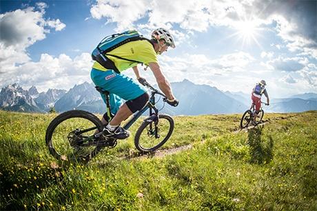
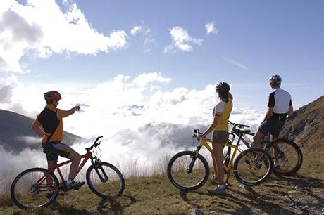
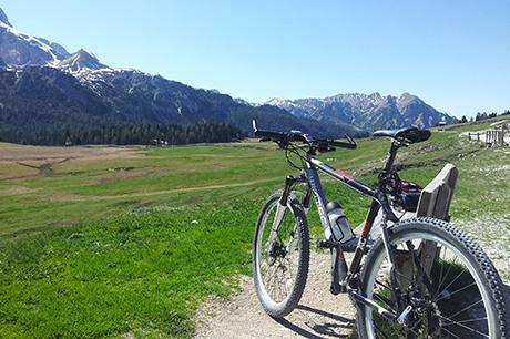
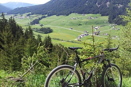
Mountain biking: life on two wheels

The area of the Three Peaks offers one of the most beautiful and inviting backdrops on earth for a whole range of mountain bike tours! You will see that the mountains are not only the perfect destination for walkers and mountain climbers but also for cyclists.
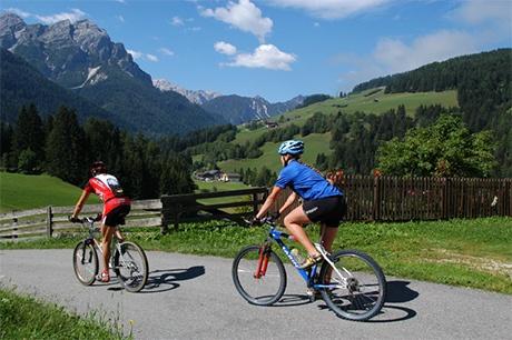
Easy Bike Tours:

  • Val Pusteria cycle path west: easy route to Rio di Pusteria. Return to Villabassa on the train.
  • Val Pusteria cycle path east: flat, easy route from San Candido to Lienz (Austria). Return on the train.
  • Braies – San Candido:  a flat route, taking you from Braies, over Villabassa to Dobbiaco and San Candido… 
  • From Braies to Cortina, via Dobbiaco: Cycle though Val di Landro to Lake Dobbiaco on one of the old Dolomite railways, past the Three Peaks View to Lago di Landro and Cimabanche. From there, enjoy a light downhill route through tunnels to Cortina.
  • From Braies over the ridgeway to Riscone, returning on the cycle path
  • From Braies to the Grünwald pasture.

Difficult Tours:

  • Prato Piazza: Cycle through Val di Braies on the Prato Piazza – a fascinating panoramic view at an altitude of 2000m! Then back over Val di Landro and the old military road, Dobbiaco and Villabassa.
  • The Stoneman-Trail is an unforgettable mountain biking experience in the Dolomites
  • Dolomiti Super Bike is the hardest mountain bike race in the Dolomites

Weitere Touren mit Karte:

Easy
Hotel Erika - OberOlang/Saller - Hotel Erika
  • Prags-Welsberg-Olang
  • 1h 15min 20,5 km
Hotel Erika - OberOlang/Saller - Hotel Erika
  • Prags-Welsberg-Olang
  • 1h 15min 20,5 km
  • Hotel Erika
  • Hotel Erika
  • 209 m
  • 4
  • 3
Normal
Cimabanche-Misurina-Cortina-Cimabanche
  • Cortina
  • 3h 40 km
Cimabanche-Misurina-Cortina-Cimabanche
  • Cortina
  • 3h 40 km
  • Cimabanche
  • Cimabanche
  • 900 m
Hard
Hotel Erika - Schluderbach - Plätzwiese - Stolla Alm - Hotel Erika
  • Prags, Toblach - Braies, Dobiacco
  • 3h 40min 45 km
Hotel Erika - Schluderbach - Plätzwiese - Stolla Alm - Hotel Erika
  • Prags, Toblach - Braies, Dobiacco
  • 3h 40min 45 km
  • Hotel Erika
  • Hotel Erika
  • 1100 m
  • 5
  • 5
Normal
Hotel Erika - Toblach - Gsiesertal - Hotel Erika
  • Toblach, Gsiesertal - Dobiacco, Valle di Casies
  • 2h 30min 35 km
Hotel Erika - Toblach - Gsiesertal - Hotel Erika
  • Toblach, Gsiesertal - Dobiacco, Valle di Casies
  • 2h 30min 35 km
  • Hotel Erika
  • Hotel Erika
  • 620 m
  • 4
  • 3
Normal
Hotel Erika-Ried/Reischach-Hotel Erika
  • Prags,Welsberg, Olang, Bruneck - Braies, Monguelfo, Valdaora, Brunico
  • 3h 46 km
Hotel Erika-Ried/Reischach-Hotel Erika
  • Prags,Welsberg, Olang, Bruneck - Braies, Monguelfo, Valdaora, Brunico
  • 3h 46 km
  • Hotel Erika
  • Hotel Erika
  • 800 m
  • 3
  • 4